Fleet Management System
Integrated Land & Water Fleet Management
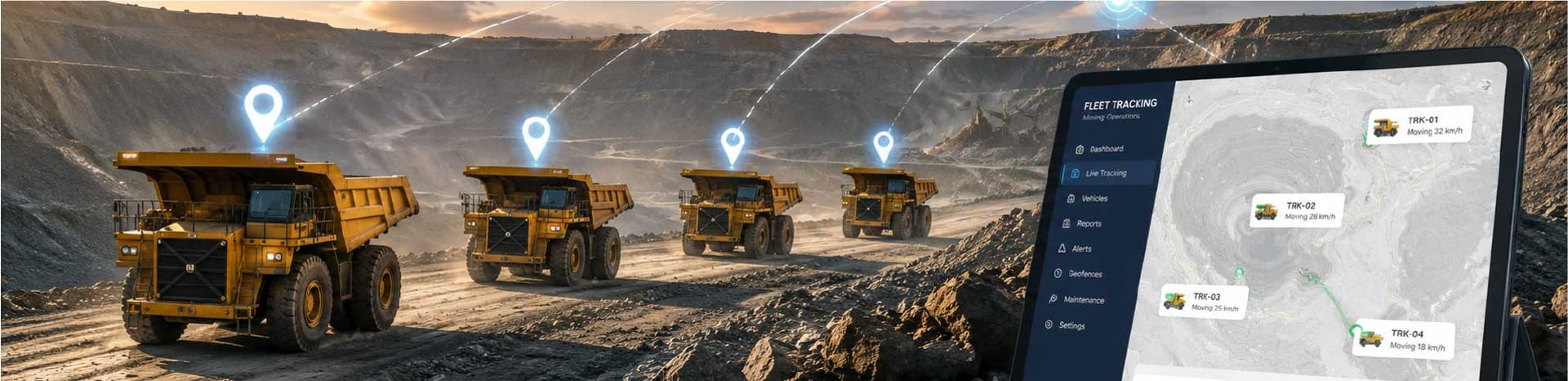
Land Water Fleet Management is an integrated tracking and monitoring solution designed to manage both land and water assets through a single platform. The system supports real-time visibility for vehicles, vessels, barges, pontoons, and even field personnel, helping operators improve control, safety, and operational efficiency across logistics, mining, shipping, and industrial activities.
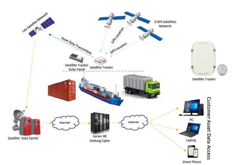
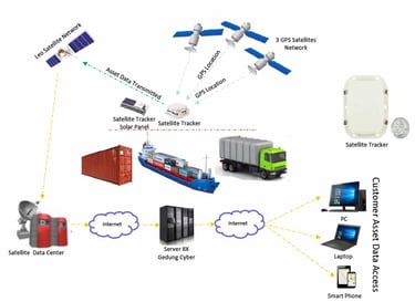
Using GPS tracking technology with GSM/GPRS or satellite communication, the solution collects location data from field assets and sends it to a centralized server for near real-time monitoring. Data can be accessed through a web-based application on computers or smartphones, allowing users to monitor asset utilization, trip history, fuel usage, movement patterns, and maintenance needs anytime and anywhere.
For water-based operations, the system can combine AIS Class A, AIS Class B, and GPS (VMS) data to improve vessel visibility and route monitoring. This makes the solution suitable for managing tug boats, mother vessels, barges, pontoons, and other marine assets operating across rivers, ports, coastal areas, and open waters.
To strengthen control and responsiveness, the platform supports operational alerts and reporting features such as engine on/off, movement alarms, overspeed alerts, geofence notifications, external power disconnection, SOS emergency button, fuel monitoring, temperature monitoring, and route or trip reports. Data history, alarm logs, and performance reports can also be exported in Excel or PDF format for operational review and management reporting.
Real-time tracking for vehicles, vessels, barges, pontoons, and field personnel through one integrated platform.
Supports both GSM/GPRS and satellite-based communication for broader coverage across land and water operations.
Helps monitor asset utilization, trip history, fuel consumption, driving behavior, and maintenance schedules.
Provides alerts for overspeed, movement, geofence, power disconnection, and emergency SOS events.
Can integrate AIS Class A/B and GPS (VMS) for improved marine fleet visibility and route control.
Web-based platform with map visualization, reporting tools, and export features for daily operations and management analysis.